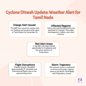
Get the Cyclone Ditwah live tracking latest update as the storm nears the coast, bringing extremely heavy rain to Tamil Nadu, Puducherry, and Andhra Pradesh districts including Chennai and Nellore. Check the IMD Red Alert warnings and crucial coastal safety advice now.

Cyclone Ditwah Live Tracking
The threat posed by Cyclonic Storm Ditwah has reached its critical peak, yet the latest bulletin from the India Meteorological Department (IMD) offers a nuanced but equally severe warning: while a formal landfall is not expected, the system remains dangerously close and is tracking parallel to the North Tamil Nadu–Puducherry coasts. As of the latest Cyclone Ditwah live tracking latest update, the core of the storm is located just 80 km from the coastline and is expected to move within a minimal distance of 25 km by Sunday evening, generating conditions equivalent to a direct hit.
This means that despite the official absence of a “landfall” declaration, the coastal regions, particularly Chennai, Puducherry, and districts stretching into Coastal Andhra Pradesh, are enduring the full brunt of the storm’s outer bands. The immediate danger is not the wind, which is strong but expected to weaken, but the sheer volume of water: the IMD Red Alert remains active for widespread Extremely Heavy Rain in several vulnerable pockets.


