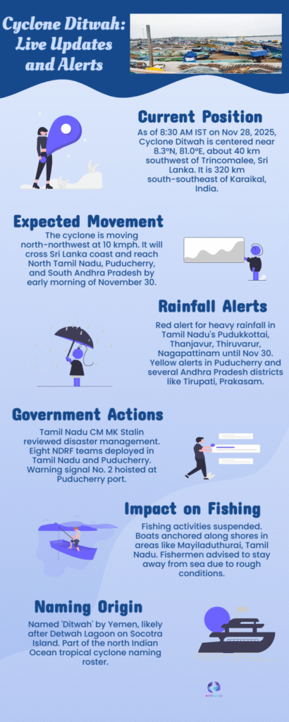
Cyclone Ditwah is intensifying in the Bay of Bengal, prompting Red Alerts for delta districts and heavy rain warnings for Chennai, Kancheepuram, and Nellore. Get the latest IMD storm track, expected landfall time on November 30, and critical safety advisories for Tamil Nadu and coastal Andhra Pradesh.
Cyclone Ditwah Landfall Date Red Alert Districts Tamil Nadu Andhra
The coastal regions of South India are on high alert as Cyclonic Storm Ditwah intensifies over the Southwest Bay of Bengal and rapidly tracks toward the Indian mainland. Originating as a deep depression near the Sri Lankan coast, the system is projected to approach the coasts of North Tamil Nadu, Puducherry, and South Coastal Andhra Pradesh by the early morning of November 30, 2025. This looming threat has prompted the India Meteorological Department (IMD) to issue stern warnings and escalate alerts, urging residents to prepare for extremely heavy rainfall and destructive winds.
The latest IMD forecast confirms that Ditwah is moving steadily in a north-northwest direction, continuing its path parallel to the Sri Lankan coast before making its decisive turn towards the Indian coastline. While the storm is currently classified as a cyclonic storm and not expected to reach ‘Severe Cyclone’ status, the projected wind speeds near the core—ranging from 60 to 80 kmph and gusting up to 90 kmph—are sufficient to cause significant damage to temporary structures and coastal infrastructure.

